Projects: Mapping the Walk and other projects
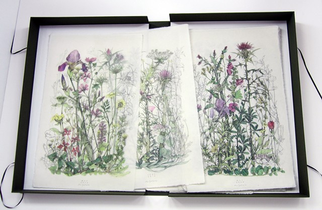
Mapping the Walk Archive. 50 Graphite and gouache drawings on mulberry paper
Mapping the Walk is an archive of 50 original graphite and gouache drawings on mulberry paper drawn from 2011 to 2020. Each of the drawings is a composite image based on observations and drawings by the artist in field sketchbooks of flora growing along a single ancient footpath on the Cycladic Island of Kea. The footpath once stretched to the north tip of the island, however, in recent years paved roadways have destroyed all but the small section leading from Ioulis, passing the ancient Lion of Kea, and ending at the paved road just beyond the Benjamin Spring. The composite drawings represent walks taken each month along the remaining footpath, as a way to honor and document the path itself via its plants; at once the most consistent feature of the path but at the same time the most ephemeral and changing. 36 of the drawings done from 2011 - 2016 are in the collection of the Gennadius Library of the American School of Classical Studies, Athens , Greece. The archive of drawings can be seen on request at the library ( AF-A. 42,CI, Q)
